
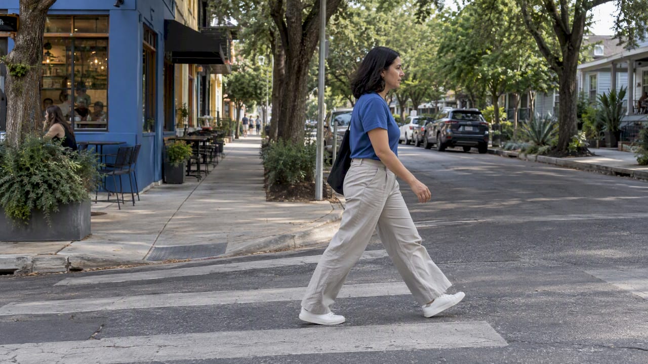
The most walkable neighborhoods in Austin are West Campus, the University of Texas area, North University, Downtown, South Congress, Bouldin Creek and Zilker. They pair dense blocks of groceries, coffee and restaurants with transit lines or trail access. West Campus leads with a Walk Score of 92, while the city average sits at 42, and the Austin Strategic Mobility Plan is steering sidewalk work.
TL;DR:
- The UT area scores 89 and North University scores 84; choose the former for campus amenities and the latter for quieter residential streets.
- For car free access, look within a half mile of frequent transit and check whether groceries and coffee are a 10 to 15 minute walk.
- Inspect regular routes for continuous sidewalks, curb ramps, safe crossings, and lighting after dark; historic blocks may be charming but uneven underfoot.
- Walkable blocks often cost more per square foot, so decide how much living space you will trade for shorter errands and easier transit access.
- Austin prioritized 94 miles of Tier 1 Urban Trails, but planned improvements are not current amenities; test routes in summer heat and after rain.
Table of Contents
- 1. Which walkable neighborhoods in Austin should you shortlist?
- 2. How do you judge a neighborhood’s walkability before you move?
- 3. How do transit, trails and city plans shape walkability?
- 4. What accessibility features should differently-abled pedestrians look for?
- 5. How do Austin’s seasons affect walking?
- 6. What do pedestrian safety statistics tell you?
- 7. A Realtor’s view: what do movers actually ask about walkability?
- 8. Want a walkable shortlist built around your life?
- FAQ
- Sources
1. Which walkable neighborhoods in Austin should you shortlist?
Austin’s walkability changes block by block, so treat these profiles as starting points, not guarantees. Scores come from Walk Score’s 2026 Austin data where it publishes them. Where it does not, we describe the pattern qualitatively and leave out a number.
- West Campus. Walk Score of 92, the highest in the city. Everything from late-night food to the UT campus sits within a few blocks, and several CapMetro routes run through the area. Housing is mostly apartment buildings and older converted houses, with rents and prices shaped by student demand. Best for students, grad students and anyone who wants to skip a car entirely. Standout: the strongest day-to-day walking in Austin.
- University of Texas–Austin area. Walk Score of 89. You can walk to campus libraries, museums, cafes and bookstores, and bus service is dense. Housing mixes condos, apartments and some older homes. Best for faculty, staff and people who want a campus-adjacent routine. Standout: cultural and academic amenities on foot.
- North University. Walk Score of 84. A residential grid just north of campus with corner shops, restaurants and quick access to bus corridors. Housing runs from small apartments to older bungalows. Best for graduate students and young professionals who want a quieter street than West Campus. Standout: walkable without the campus crush.
- Downtown Austin. The densest concentration of restaurants, offices, venues and hotels in the city, with the heaviest transit presence, including CapMetro’s Red Line rail terminus. Housing is almost entirely high-rise condos and apartments, and it carries a premium price signal. Best for remote workers, professionals and people who want events and nightlife at the door. Standout: the only place where a car is genuinely optional for nearly everything.
- South Congress (SoCo). A lively corridor of shops, restaurants and music venues, served by frequent bus service along Congress Avenue. Housing ranges from mid-rise apartments along the strip to bungalows a few blocks off. Prices are high for the area. Best for people who like a strong street scene. Standout: the most recognizable walkable strip south of the river. For more on how south-side areas compare, see our guide to South Austin neighborhoods.
- Bouldin Creek. A residential neighborhood just south of Lady Bird Lake with bungalows, newer infill and a mix of coffee shops and restaurants on South 1st Street and South Congress. The lakeside trail is close, and downtown is within walking or biking distance. Best for people who want a neighborhood feel with city access. Standout: quiet streets with easy reach of both SoCo and downtown.
- Zilker. Direct access to Zilker Park, Barton Springs and the Lady Bird Lake trail system. Daily errands are less walkable than in the urban core, but recreation on foot is hard to beat. Housing is mostly single-family homes with a premium price signal. Best for active households and dog owners. Standout: the best trail and green space access on this list.
- East Cesar Chavez / Central East Austin. A fast-changing area east of I-35 with restaurants, coffee shops and murals, connected to downtown by short walks and bus routes. Housing is a blend of older homes, new town homes and apartments. Best for people who want a creative, food-forward neighborhood close to downtown. Standout: walkable dining with easy access to the lakefront trail.
- Clarksville. One of Austin’s oldest neighborhoods, west of downtown, with small shops, cafes and a historic feel. Streets are shaded and relatively compact. Housing is largely older single-family homes with high prices. Best for buyers who want historic character and a short trip to downtown. Standout: a village feel minutes from the center.
- Old West Austin / Hancock. Established residential areas near downtown and the Shoal Creek and Waller Creek corridors, with parks, neighborhood shops and a strong bike and walking culture. Housing leans toward single-family homes and carries a high price signal. Best for families who want mature trees and proximity to the core. Standout: peaceful residential walking close to the center.
Quick comparison of what to weigh across the shortlist:
- Highest Walk Scores: West Campus, UT area, North University.
- Best for transit-first living: Downtown, West Campus, UT area.
- Best for trails and green space: Zilker, Bouldin Creek, East Cesar Chavez.
- Best for neighborhood character: Clarksville, Old West Austin, Hancock.
- Best for a street scene: South Congress, Downtown.
If you want to see how walkability maps onto cost, our look at neighborhood price patterns across Austin shows what sold homes reveal.
2. How do you judge a neighborhood’s walkability before you move?
A Walk Score is a useful first filter, but it does not tell you whether the sidewalk is broken or whether a crossing feels safe. AllTransit’s metrics point out that being within a half-mile of a high-frequency transit route is a more reliable sign of car-free access than a neighborhood label alone. Use these checks to compare areas on equal terms:
- Transit proximity: aim for a half-mile or less to a high-frequency corridor.
- Daily essentials: a 10 to 15 minute walk to groceries and coffee is a practical standard.
- Sidewalk continuity: look for unbroken sidewalks on both sides, not just a stretch near the shops.
- Crossings: check for marked crosswalks, signals and median refuges on busy roads.
- Safety and lighting: walk the route after dark at least once.
- Green space: a park or trail within a short walk improves daily life and resale appeal.
- Housing trade-off: the most walkable blocks often cost more per square foot, so decide how much space you will trade for convenience.
On a site visit, walk your real routine: to the grocery store, to the bus stop, to a coffee shop. Note curb ramps, gaps in the sidewalk, and how long you wait at crossings. Online, use street view to scan the same route before you travel. If you spot a missing or dangerous sidewalk segment, you can report it through Austin 3-1-1, where the request is reviewed against the city’s infrastructure plans.
Pro Tip: Students should prioritize bus frequency and distance to campus, families should weigh crossings and park access, and remote workers should check for a nearby coffee shop and grocery within a comfortable walk.
A short checklist for your tour:
- Walk to the nearest grocery and time it.
- Locate the nearest high-frequency bus stop or rail station.
- Walk one block off the main street and check sidewalk condition.
- Cross the busiest street nearby at rush hour.
- Check the streets again after sunset.
For buyers working through the budget side, our guide to Austin starter homes explains how to focus your search by geography.
3. How do transit, trails and city plans shape walkability?
Walkability in Austin is not fixed. The city’s Austin Strategic Mobility Plan is the City’s long-range multimodal transportation framework. City Council adopted the 2023 Bicycle Plan, Urban Trails Plan, and Sidewalks, Crossings, and Shared Streets Plan on November 30, 2023. These plans guide future improvements; adoption does not mean the proposed infrastructure is already built.
- Sidewalk upgrades are equity-based. The Sidewalks, Crossings, and Shared Streets Plan uses equity- and data-focused priorities, including pedestrian-network and crossing analysis; project schedules still vary by route and funding.
- Tier 1 trails are planning priorities. The 2023 plan identifies 94 miles of Tier 1 Urban Trails as high-priority projects in the proposed network, not completed amenities.
- Transit shapes car-free life. CapMetro’s Red Line rail and high-frequency bus routes such as the 801 and 803 are built around north-south corridors, while east-west trips tend to be harder. Many car-free residents plan trips in the Transit app.
- Vision Zero and local programs. The city’s Vision Zero effort and the Neighborhood Partnering Program give residents a path to propose local connectivity improvements.
The practical takeaway: a neighborhood near a planned trail or a priority sidewalk corridor may improve over time, but do not pay today’s price for tomorrow’s promise without checking current conditions.
4. What accessibility features should differently-abled pedestrians look for?
Walkability means little if a curb ramp is missing. Austin runs several pedestrian programs, including ADA transition work, curb ramps and crossing upgrades, that shape how usable a neighborhood is for wheelchair users, people with low vision and anyone pushing a stroller.
When you tour a neighborhood, check these features:
- Curb ramps at every corner, with a smooth transition to the street.
- Sidewalk width and surface, free of cracks, roots and utility poles blocking the path.
- Signal timing and audible or tactile signals at busy crossings.
- Bus stop access, including a level boarding area and a bench.
- Building entrances with step-free access, which is common in newer downtown and mid-rise buildings.
Older, historic neighborhoods can be charming on foot yet uneven underfoot, while newer infill and downtown buildings usually offer better step-free access. If a gap is serious, report it through 3-1-1 so it enters the city’s review queue. For rights questions tied to housing, HUD’s fair housing contact page is the federal starting point.
5. How do Austin’s seasons affect walking?
Austin’s climate changes how walkable a neighborhood feels as much as its sidewalks do. Summer heat can make walks feel longer, so shade, tree cover and nearby indoor stops matter. Clarksville, Old West Austin and the trail corridors around Lady Bird Lake tend to feel more comfortable in warm months because of mature trees and water access.
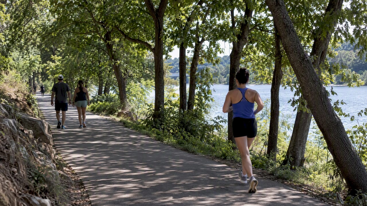
Spring and fall are the best seasons for walking, which is when many movers do their neighborhood visits. Winter is generally mild, though occasional cold snaps and ice can make elevated sidewalks and bridges tricky. Heavy rain can flood low-lying creek crossings and trail segments, so check whether your daily route depends on one.
Practical steps:
- Visit candidate neighborhoods in the heat of the afternoon, not only on a mild morning.
- Look for shaded routes to your grocery store and bus stop.
- Favor bus stops with shelters if you plan to commute without a car.
- Keep a backup route in mind for rainy days.
Walkability on paper does not always match walkability in August, so test it in conditions you will actually face.
6. What do pedestrian safety statistics tell you?
Safety is a real part of the walkability picture. The city’s Pedestrian Program publishes data showing how crash severity relates to distance from signalized crossings, which is a reminder that long gaps between safe crossings carry risk. The broader policy shift toward a multimodal network, described in the ASMP policy document, reflects the city’s push through Complete Streets and Vision Zero to make walking safer.
What this means for you:
- Prefer blocks where signalized or marked crossings are close together.
- Be cautious about wide arterial roads with few crossings, even in neighborhoods with a high Walk Score.
- Check lighting and sidewalk separation from traffic on your regular routes.
- Ask neighbors where they feel unsafe crossing and why.
We do not quote neighborhood-level crash counts here because they shift year to year and by corridor. For current figures, check the city’s Vision Zero and pedestrian safety pages directly, and compare the specific streets you would use rather than a whole neighborhood.
7. A Realtor’s view: what do movers actually ask about walkability?

In our conversations with people moving to Austin, the same questions come up: can I live here without a car, what happens to parking, and how long is the commute? My view is that walkability is a lifestyle filter before it is a price filter. Buyers who start with a Walk Score often discover that the real deciding factors are shade, crossings and the one grocery store they will use every week. Walkable areas also tend to hold desirability because the convenience is hard to replicate elsewhere.
My advice is simple: shortlist three neighborhoods, walk each one at the time of day you would use it, and check the bus schedule in the Transit app before you commit. For a wider view of the north-south divide, our piece on North vs South Austin tradeoffs helps frame the decision.
— Vladimir
8. Want a walkable shortlist built around your life?
Narrowing the options to the right two or three takes local knowledge and a few walks on real streets. We help movers do exactly that at ATXCasa:
- A tailored neighborhood shortlist based on your budget, commute and car-light goals.
- Data-driven local insight on prices, inventory and trends.
- Walking-focused buyer tours so you can test blocks before you commit.

Reach out through our site and we will start with your priorities and map out a plan to see the neighborhoods that fit.
FAQ
Is Austin a walkable city overall?
Austin is walkable in pockets, not citywide. The city-wide average Walk Score is 42, while the downtown and university core score far higher. Where you live matters more than the city label.
Can you get around Austin without a car?
Yes, in the right neighborhood. Living within about a half-mile of a high-frequency CapMetro route in places like West Campus, Downtown or the UT area makes car-free living realistic, though east-west trips can be harder.
Which part of Austin is the best for walking?
West Campus, the UT area and North University have the highest Walk Scores, while Downtown and South Congress offer the strongest mix of dining, transit and street life. The best fit depends on whether you want student energy, urban density or a quieter residential feel.
Where can you go for a walk in Austin?
The Lady Bird Lake trail system and Zilker Park are the best-known options, with Bouldin Creek and East Cesar Chavez giving easy access. The city is also building out its Urban Trails network, with roughly 86 miles of Tier 1 trails prioritized.
Sources
- Austin Apartments for Rent and Austin Rentals – Walk Score
- Austintexas
- AllTransit Metrics
- ASMP Amendment Log November 30, 2023
- Austintexas